The poisonous legacy of the First World War—which officially ended on November 11, 1918—continues to be felt on the French-Belgian border to this very day, where a 38 square mile (100 square kilometer) stretch of land is still officially an uninhabitable no-man’s-land, to which human access is legally barred.
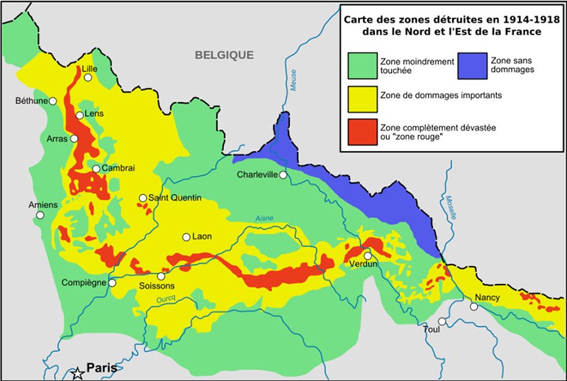
The cordoned-off area, little known outside of the local region, is inside an area officially known as the Zone Rouge, (the “red zone”). This Zone Rouge is located in a long strip running from the cities of Lille to just past Nancy, and marks some of the worst areas of destruction during the 1914–18 war.
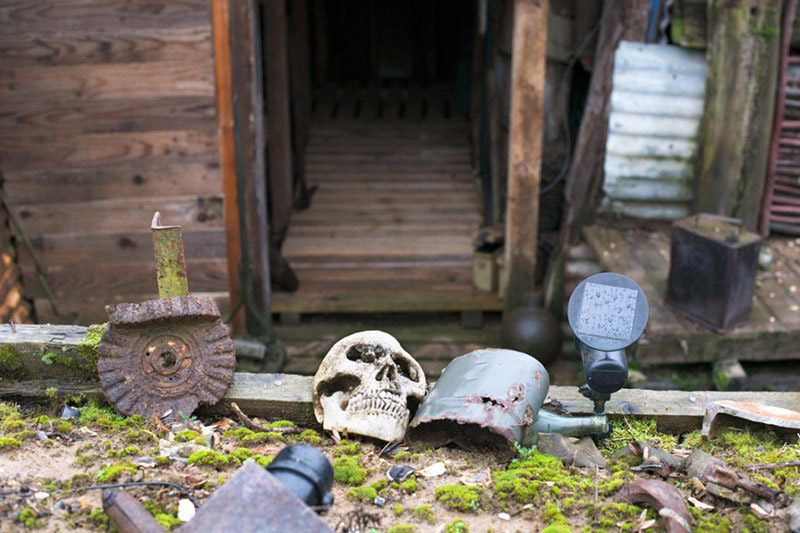
After the war, the Zone Rouge was subjected to a “clean-up” which consisted of destroying the unexploded shells with explosives in the open air. In one area, however, just outside the city of Verdun, some 200,000 unexploded munitions were simply buried.
It is this area, now known as the Place-à-Gaz, or the “place of gas,” which was identified in 2004 by researchers from the Gutenberg University of Mainz and the French National Forestry Office as being still highly toxic.
A chemical analysis of the area found dangerous levels of up to 17 percent arsenic in the soil, tens of thousand times higher than levels found within the rest of the Zone Rouge.
After more intensive investigations and discussions with local authorities, the French government finally formally prohibited all human access to the area in 2012—a real, still-existing no-man’s-land, dating from that terrible war.

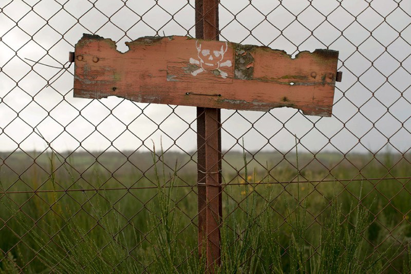
“Military Property, do not enter, danger of death”
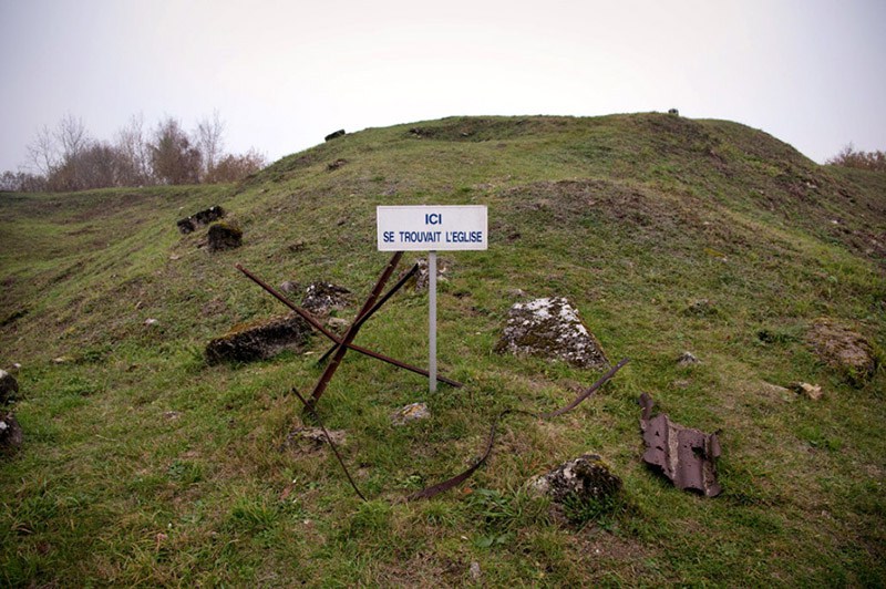
“Here stood the church.”
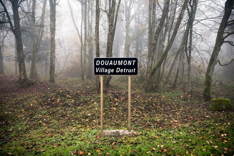
“Douaumont, Destroyed Village”
The North and Pas-de-Calais regions of France also suffer from other legacies of the war. In 2012, the drinking water of more than 500 municipalities in those regions was declared unfit for human consumption due to abnormally high levels of ammonium perchlorate, and to this day (2015) over 400 of the municipalities still have usage restrictions on local water.
According to an article in Le Monde, health officials in the region “remain vague about the origins of pollution, but the mapping of the affected sites corresponds to that of the hardest fighting [in World War I]. For the mayors concerned, there is no doubt about the causes…”
French photographer Olivier Saint Hilaire has captured every facet of this forbidden French no-man’s-land. Find his website and more photographs featured in this article here.